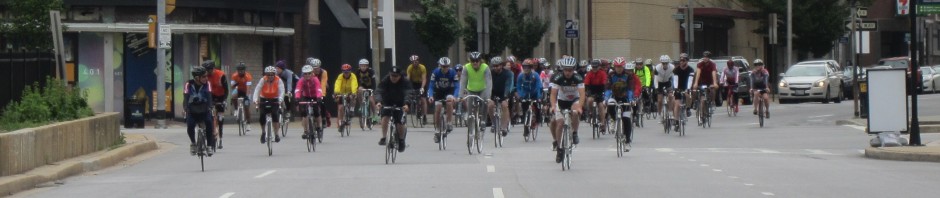

Nearing the National Mall in 2012
I did a partial M2M check-out ride this morning, in the rain no less, and it got me really psyched to get the bike rolling with y’all on Sunday. I tweaked the route a little bit and have the final map and cuesheet posted below. I will bring cuesheets to the start. If you use a GPS, click the map/gps link below. Along the right column of Ride w/GPS hit the “Export” tab where you’ll see links to gps files. This route has a lot of cues and using GPS will be helpful.
I expect you’ve got yourself in good shape to finish M2M comfortably. This week you should spend your time preparing your bike and supplies. Double check your equipment: bike, tires, lights, clothing, glasses, sunscreen, water and cell phone. Be sure everything’s ready the night before the ride.
The M2M route is a combination of paved trails, bike lanes and public roads. We stop for food and bathroom breaks 3 times. Twice at a convenience store near Laurel, MD and once for lunch at Union Station in DC. Bring money for food. You won’t need a lock, there are enough of us to guard bikes while others are inside.
Oh yeah, get psyched. This is a lot of fun.
Cue sheet: http://tinyurl.com/d9eyuby
Map/GPS: http://ridewithgps.com/routes/2429638

Pingback: I just want to feel this moment. | Meghan'sMind
Pingback: Back on My Two Feet: The Potomac River Run Marathon | chasing mailboxes d.c.
Hey, tweeter/instagram/tumblr’s use: #bikeM2M for postings. see ya
YES!
I plan to ride from home (joining Bob’s route at the 7-11 rest stop) and meet you all at the Washington Monument. For the return trip, Isaias has promised to stay up front and not worry about about me when (not if! :)) I fall off the back of the pack and solo the rest of the way home. 😀
eli, we have riders at all paces, you just have to finish. what many don’t think about is that the slower you go the longer you’re on that saddle.
Any CC pace people doing the ride? (CC being the PPTC standards, so guessing low 13-15 BBC pace for a century this early in the year) Not sure if I really want to do a century ride solo
Hey Carl (and anyone else meeting in Catonsville) Atwaters doesn’t open until 8. I’ll still be there but don’t expect to eat/drink if you arrive early.
7-11 (rest stop)
10930 Guilford Rd Annapolis Junction MD 20701
I have edited the gps file to give warnings for each turn 200m in advance and at the turn, also I removed all but the street name, since some Garmins only show the first 10 characters of the description:
https://docs.google.com/file/d/0ByVSJyf85uyDeGpTM0dBV2x5eFU/edit?usp=sharing
wow. thanks for that, onelegmatt
@ Mike.
I hope this helps.
https://docs.google.com/file/d/0BzOZX3YP6cw8N1ZaVUpNMVpFd1U/edit?usp=sharing
I hope to be there. This looks like a really interesting/fun ride.
I’ll be driving from PA, so thanks for the parking lot map.
Hey Bob,
I’d like to import the tcx file to my 305 Garmin but Ride with GPS requires a premium membership. Do you have this file available for me to upload? See ya on Sunday.
Thanks,
Mike
Brian, rest stop in Laurel is the 7-11 on Guilford between Brock Bridge and Dorsey rd.
Carl, you’re right stoked is better. As long as no one gets tickled pink.
nockinon7sdoor, this has good info for parking: http://www.flowermart.org/parking.html
Any good place to park near the start? Coming in from Harford County, too far to ride to the start.
Planning on attending.
Bill
__o _ \ <_ (_)/(_)
Sent from my iPhone
Unfortunately, no. I have a swim in the Nanticoke River Sunday that is in preparation for my 7.5 mile swim on June 1st. Hope all is well.
Sent from my iPad
Psyched? Us mt. bikers don’t get psyched, we get STOKED!
I’ll most likely be riding the road bike this year- but I’m Stoked! regardless:-)
(I believe the first rest stop is in the annapolis junction area)
Where is the stop in Laurel? That’s where I’ll connect with you. What do you estimate will be your approximate ETA?